Lightning tells us more about severe weather than you might imagine.
Did you know that lightning is a key indicator of severe weather and present in most storms? The Earth Networks Total Lightning Network monitors the skies 24/7, 365 days a year for both in-cloud and cloud-to-ground lightning strikes (aka "total lightning"). When our global network of lightning sensors detect lightning, it automatically issues severe weather alerts to impacted areas - up to 50% faster than other sources. This technology saves lives every day and reviewing the historical data helps us plan for the next severe weather event.
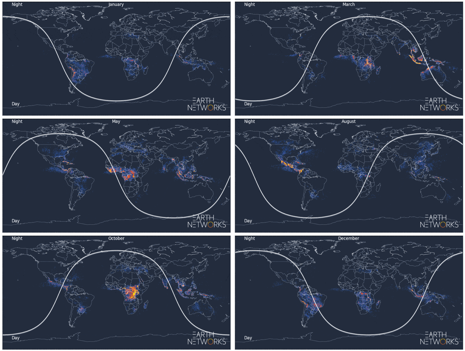
In the month-by-month time lapse shown below, you can see the seasonality of lightning and storm activity for different parts of the world as detected by our lightning network in 2019.

To help you plan ahead for severe weather, we've compiled the U.S. lightning data (January 1 to December 31, 2019) into a 16-page report, which you can flip through below.
What's included in the 2019 U.S. Lightning Report?
- An overview of total lightning activity in the U.S. during 2019
- Total lightning data for every continental U.S. state and the Top 100 counties struck by lightning
- Lightning density maps for the continental U.S. and key geographical regions
- An overview of how lightning played a role in 2019's severe weather events across the country


