Military
From the airbase to land and sea operations, we help military teams anticipate changing weather conditions – providing safety and military base resiliency every day.

From the airbase to land and sea operations, we help military teams anticipate changing weather conditions – providing safety and military base resiliency every day.

Our software translates forecasts and monitoring data into clear, actionable narratives.

We offer a comprehensive approach to climate resilience and severe weather risk.

We enable interagency collaboration to mobilize weather data when it’s needed most.

Threat tracking
Whatever your operation, we can address all hydrometeorological threats including severe weather, wildland fires, flooding, river flows, and dam safety. We provide actionable information for enhancing mission readiness and community preparedness.

global lightning detection
With more than 1,800 sensors in over 100 countries, we deliver comprehensive data wherever you operate. 95% detection efficiency means you can count on accurate data which serves military teams operating across the US and beyond.

your trusted partner
Protect people and assets with automated siren alerts and countdown clocks. Everyone has the same information at the same time, helping you clear airfields and other workspaces before storms arrive. And when the danger has passed, your team can get back to work as quickly as possible.

AEM Elements 360 is a multi-hazard weather intelligence solution and the cornerstone of the Elements Resiliency Platform.
Find out more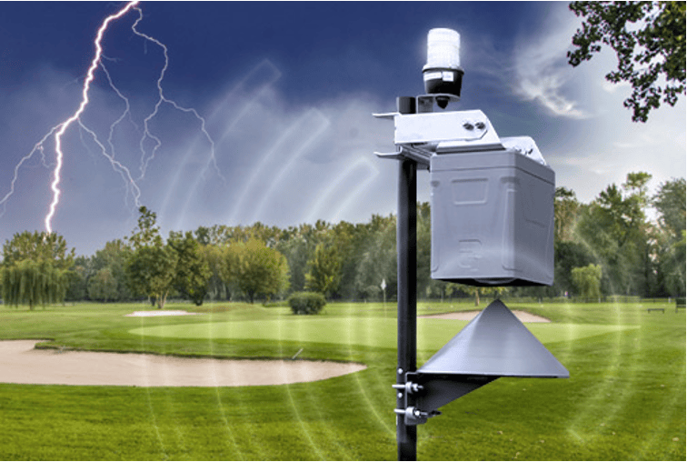
Make sure everyone knows lightning is on the way with our automated outdoor warning siren.
Find out more
The ultimate severe weather visualization, decision support, and alerting tool, with a vast library of weather observation layers.
Find out more
Deploy a custom public or private lightning detection network to improve the accuracy, reliability, and security of weather information.
Find out more


